
Notes
Where urban datasets disagree
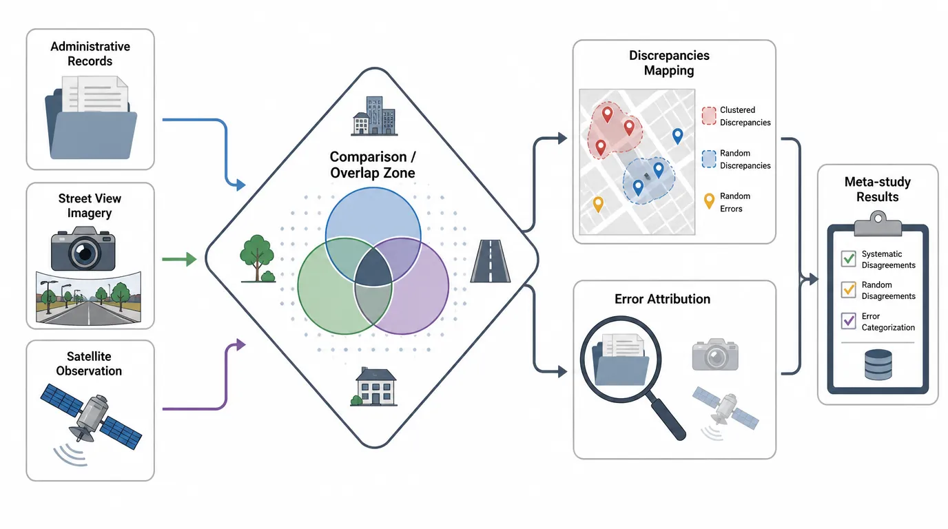
Administrative records, street view, and satellite observation describe the same city differently. I want to chart where they contradict each other and which source carries the error.
The idea
Look at the same city through administrative records, street view imagery, and satellite observation at the same time, then chart where they contradict each other. Which source drifts, what kinds of objects it gets wrong, whether the errors cluster. A meta-study of the data rather than of the city.
Open questions
- Which disagreements are systematic and which are just noise?
- When two sources conflict, what counts as ground truth?